ATV Adventures: Much to explore on the Shoshone OHV Trail System


-

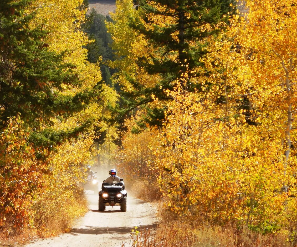
- Fall colors on the Shoshone OHV Trail System.
-

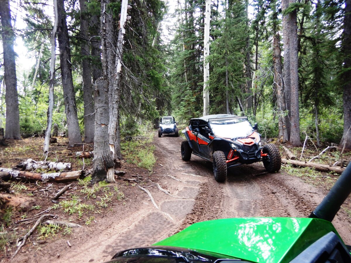
- Enjoying a cool ride in September on the Shoshone OHV Trail System.
-

- Riding the Shoshone in late August.
-

- Lynn Blamires
As promised, I am writing a series of articles on off-highway vehicle, or OHV, trail systems in Utah. The purpose is to educate new OHV drivers on places to ride that new machine and to enjoy the beautiful backcountry available to OHVs. The focus of this article is the Shoshone OHV Trail System.
Located in the scenic Wasatch-Cache National Forest and adjacent to Bureau of Land Management lands, the Shoshone Trail is proof that northern riders don’t have to travel hundreds of miles to enjoy great trails.
The Shoshone Trails have been open since 2004 and are fully contained within the borders of Cache and Rich counties. The Northwestern Band of the Shoshone Nation and mountain men once roamed the area in which this trail system is situated.
A point of historical interest is one of few monuments to a bear. Old Ephraim’s Grave is located in this trail system and is a popular place to visit. Old Ephraim was a grizzly bear standing 9 feet, 11 inches tall and weighing 1,100 pounds. The grave is marked by a four-and-a-half-ton monument, equal in height to the old bear. Frank Clark of Malad, Idaho, a sheepherder who lost many sheep to this ferocious bear, finally killed him in 1923. There is a painting depicting this dramatic event by Dale Burr that he painted in 1979 after learning about the story.
It is very impressive to stand at the base of this monolith and imagine facing Old Ephraim. I understand that his skull is on display at the Smithsonian Institute in Washington, D.C. More information about the story is available on the internet. I love to ride the historical areas of Utah.
Another point of interest is located at Peter Sinks. At an elevation of 8,164 feet, this natural limestone sinkhole, approximately one-half mile in diameter, can be likened to a large bowl that has no valley outlet to drain water or air. On Feb. 1, 1985, the temperature at Peter Sinks plummeted to minus 69.3 F, the second-coldest temperature ever recorded in the lower 48 states.
To give you an idea of the size of this trail system, consider the area between Logan east to Randolph and from Monte Cristo north to Peter Sinks. The 337-mile system was originally laid out to provide riders with loops small enough for a day trip or large enough to ride for two days or more. The trails are smooth for the most part and wide enough to handle the larger side-by-side machines.
Towns surrounding the Shoshone Trail System have taken advantage of the OHV traffic by facilitating access to amenities they offer. One of my favorite rides on the Shoshone is from Curtis Creek on the Monte Cristo Mountain Range. The trail goes through beautiful forests that feature overlooks of mountain ranges and valleys that seem to stretch forever. It is truly mountain man country. At a junction, the trail follows the Old Canyon Road down into Randolph where lunch awaits at The Crawford Trough.
On the other hand, checking the map, I decided to take the trail that accesses the Shoshone from Millville. On the map, the trails are color coded to show difficulty. Green is for easy trails, while the blue trails are more difficult. Black is reserved for the most difficult trails in the system. I should have remembered that when I started up Millville Canyon. It has beautiful scenery, but it was hard to enjoy because this black trail is so dang rocky. I also understand that Providence Canyon is even less paradisiacal.
Other access points include Cowley Canyon and Temple Fork from Logan Canyon, Garden City, Lake Town, Woodruff, Hardware Ranch and the Left-Hand Fork of Blacksmith’s Fork River. Eighteen years later, after these trails have been extended to access town amenities and ATV trails with width restrictions have been added, the Shoshone has grown to be a lot more than 377 miles.
There is a lot to explore on the Shoshone Trail System and worth the time to do it because the country is so amazing. Portions of this trail system open earlier than the higher mountain trail systems, which make it best to ride in the spring and fall. The lower sections can get pretty warm in the summer.
It is great to have this trail system in Northern Utah. When you go, take plenty of water, keep the rubber side down and plan to spend some time on the Shoshone trails this year.
Contact Lynn R. Blamires at quadmanone@gmail.com.