ATV Adventures: The Arapeen OHV Trail System will put you on top of the world


-

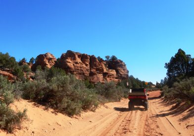
- The author and his brother-in-law, Mike Timothy, on the Arapeen trails.
-

- Starting down the New Canyon Trail in Ephraim Canyon on the Arapeen Trail System.
-

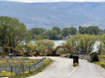
- Going through one of the big water crossings on the Arapeen Trail System.
-

- Lynn Blamires
In a continuing effort to provide information on places to ride for people new to the OHV world, I am reviewing one of my favorite trail systems in Utah. The Arapeen OHV Trail System is situated in Sanpete County, which is right in the middle of the state. That makes for a short distance vacation destination from anywhere in the state.
With winter snows receding, access to the complete inventory of trails in the Arapeen system is happening. That inventory makes this a trail system that will take time to explore. I have been visiting these trails for 30 years and I am still finding new routes to enjoy.
With over 600 miles of trail in the Arapeen Trail System and trail elevations ranging from 5,800 feet to the highest point on the Skyline Trail at 10,897 feet, this is mountain riding at its best. I can’t think of a better way to escape the heat than riding in a cool breeze in the tops of these mountains.
The Skyline Trail is the backbone of this amazing system. It extends 108 miles from Highway 6 in Spanish Fork Canyon to Interstate 70. A section of 58 miles on the Skyline is above 10,000 feet, with the highest point being 10,897 feet at a place called High Top.
Sanpete County has gone to great lengths to ensure your enjoyment of this gem of a trail system. They have produced a map detailing the 600-plus miles of OHV trails available to explore. You can also download the map to the Avenza Maps App on your smartphone to make routes even easier to follow.
You don’t have to wonder where to start or where to go — the map suggests four day rides and two overnight rides. The trails are well marked and the instructions are easy to follow. These suggested rides will give you a taste of what the Arapeen has to offer, and one trip is all it will take to have you coming back for more.
The map also appeals to fishermen, with 53 GPS coordinates for places to fish on the trail system. Hikers who want to ride to a trailhead to get deeper into the backcountry have six suggested trails detailed to enjoy. Points of interest are indicated on the map as well as GPS coordinates for four geocaches for those who like that kind of adventure. Children will want to be involved in a family adventure on these trails when they participate in the Photo Scavenger Hunt outlined on the map.
Access to the Arapeen Trails are from points on both the east and west sides of the Manti La-Sal Mountains: Fairview, Mount Pleasant, Spring City, Ephraim, Manti, Sterling and Mayfield on the west side and Castle Dale, Clawson, Ferron and Emery on the east side. In each of these cities, you can ride right from town to enjoy the trails.
When I ride Utah’s OHV trails, I like to know about the history in the areas I am riding. The Arapeen map provides some interesting information about the Old Spanish Trail that passed through here as well as Butch Cassidy and one of his sidekicks, Matt Warner, who was born in Ephraim. The remains of a wooly mammoth were found in this area. Capt. Gunnison was in this country surveying a route for the transcontinental railroad. The trail is named after the Ute Chief Arapeen.
Skyline Drive is a part of a trail system known as the Great Western Trail. This is a 3,000-mile trail system connecting Canada and Mexico. It is designed for multiple uses. While the trail exists and sections of it will accommodate multiple users, it is still in the development stage.
The Arapeen system offers a variety of trails to accommodate different users. While hiking trails have already been mentioned, single track trails are open to motorcycles and bicycles. Three different trail width designations are offered to the OHV community: trails open to all vehicle widths, trails open to vehicles of 66 inches or less, and trails open to vehicles of 50 inches or less.
To me, the best kind of trail to ride allows me to start in one city and go to another one and spend the night. The Arapeen system allows that while offering some of the most beautiful mountain trails in the country. When you go, take plenty of water, keep the rubber side down, and for more information, see https://www.sanpete.com.
Contact Lynn R. Blamires at quadmanone@gmail.com.