ATV Adventures: New OHV jamboree showcases Color Country Trail System


-

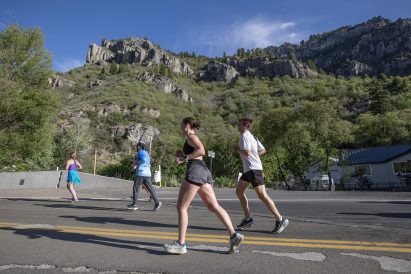
- Riding the Markagunt Trails above Cedar City. These trails are smooth and the scenery is beautiful.
-

- The Markagunt Trails are on the top of the mountain in the Dixie National Forest.
-

- The Markagunt Trail System is one of five segments in the Color Country Trail System.
-

- Lynn Blamires
The first annual Color Country OHV Jamboree will be hosted by the Iron County Event Center, the Cedar City Trail Blazers OHV Club, the D & P Performance OHV dealer, Iron County and Visit Cedar City Brian Head. If you think that is a mouthful, I am about to tell you about the event itself.
The dates are set for Sept. 27-30 in Cedar City. The registration fee is $100 per person. The fee includes three days of guided rides on the newest trail system in Utah, a jamboree T-shirt, a swag bag, a ticket for the drawing, a dinner and discounted tickets to Cedar City’s Shakespearean plays. To those of you who ain’t cultured, a swag bag is a bag filled with items that will sweet talk you into spending more time in Iron County. Its contents will please and surprise.
The trail system is called Color Country. Five trail systems have been combined to include old favorites plus miles and miles of new trails to enjoy.
The Color Country Trails are made up of these five segments:
1. The Markagunt Trails are located east of Cedar City and the other side of the mountain from Panguitch and Hatch. That mountain in between is in the Dixie National Forest and includes such places as the Panguitch Lake and Duck Creek Village. I have only been down to the Markagunt system once, but it has some of the prettiest trails I have ever ridden.
2. Bumble Bee Trails. This system is new to me. It gets its name from Bumble Bee Mountain, which is a prominent mountain in this segment along with Chloride Mountain. There is a wild horse herd that calls Chloride Mountain home. Another feature is the ghost town known as Old Iron Town. It was active after iron was discovered there. There is also a portion of the Old Spanish Trail found in this section of the Color Country Trail System.
3. The Parowan Gap Trails. Included in this segment are the famous Parowan Gap Petroglyphs and an interesting feature known as a wind gap. A wind gap is a land feature that is a cut through which water flowed at one time. Some event caused the waterway to be diverted, which changed it from a water gap to a wind gap.
This particular gap is named the Parowan Gap. Famous gaps back east include Buford’s Gap and the Cumberland Gap. These gaps have a gentle slope that makes for great trail beds.
A segment of the Dominguez Escalante trail is also found in this trail system. I love the history I have found in riding the backcountry.
4. The North Hills Trails. These are northwest of Enterprise and are bordered on the northwest corner by Modena near the Nevada border. These are desert trails that can be generally ridden year-round. I say generally because this year just might be an exception because some of them travel near elevations of 7,000 feet. They are trails, however, that can be accessed earlier in the year than those in the high mountains.
The North Hills Wild Horse Herd Management Area is located in this area and wild horses can be seen throughout the trail system. Two wild horse viewing areas have been established — one at Nephi Springs and one at Haystack Mountain.
5. The Old West Trails. Trails in this sector lay west of the railroad tracks in Lund. The major attractions include old mines and the towns that sprung up around them.
Wild horses can be seen on these trails along with elk, deer and sage grouse. The area is also popular for picking pine nuts, as the dominant pinion trees are of the single-leaf variety which are known for larger nuts.
This area is considered to be primitive. There are no designated camp sites, no waste dumping stations and no potable water.
The Color Country Trail System has combined these five riding areas into a more organized system providing trail information for 1,115 miles of trail in a wide variety of terrain. These trails range high into the lofty peaks of the Tusher Mountains and thousands of feet lower into the wiles of the Escalante Deseret.
There won’t be a map of this trail system like there is on the Paiute and Arapeen Trails, but QR codes on the maps available on the registration page are downloadable to GPS apps like Avenza. When you go, take plenty of water, keep the rubber side down and register at https://ironcountyfair.regfox.com/color-country-atv-jamboree.
Contact Lynn R. Blamires at quadmanone@gmail.com.