
On top of the world: Six peaks to summit in the Wasatch Mountains
-
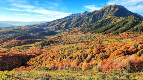
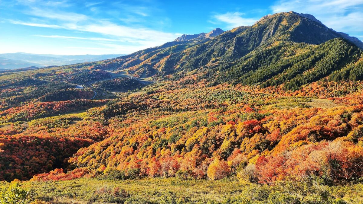
- Fall colors are beginning to blanket the mountains around Ogden in this undated photo.
-
-
Supplied Photo, Justin McFarland
Fall colors are beginning to blanket the mountains around Ogden in this undated photo.
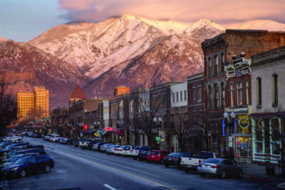
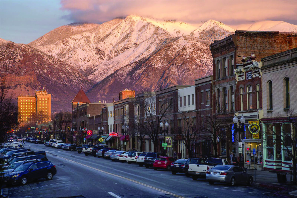
The sun sets on Mount Ogden and Historic 25th Street in downtown Ogden on Thursday, March 23, 2017.
-

-
“The Mountain Awakens,” by John Huerta Jr, depicts the light on Ben Lomond after a storm cleared, which the artist described as “unreal.”
-

- The Ben Lomond High School “BL” emblem on the mountainside above the high school, photographed Wednesday, Oct. 11, 2023. Boosters placed lights around the emblem as an experiment to see how it would look.
When driving or walking along through the roads and neighborhoods in northern Utah, the mountains that surround us often grab our attention.
Whether it is the stunning colors of a dramatic sunset or the picturesque manner that the clouds cling to the peaks, those crags fire the imagination.
Sometimes, however, just looking at those mountains just isn’t enough.
BENJAMIN ZACK/Standard-Examiner
The sun sets on Mount Ogden and Historic 25th Street in downtown Ogden on Thursday, March 23, 2017.
You want to see the view from the summit.
It’s a daunting prospect, usually requiring plenty of physical preparation. It requires mental fortitude and the ability to handle jaw-dropping heights and difficult climbs.
For those who put in the effort, though, the reward can be indescribable as you get to see the world spread out below you.
Are you interested in taking on the challenge?
If you are, August is often a good time to get in the high country, with the snows having melted (what snows there were this year) and better odds on the weather. There are plenty of resources to help you decide where to go and which to do. Many websites can provide trail recommendations, parking tips and ways to make the most of your hiking.

Photo supplied, Canyon Gallery
"The Mountain Awakens," by John Huerta Jr, depicts the light on Ben Lomond after a storm cleared, which the artist described as "unreal."
Here is a look at how experts view six of the many climbable peaks in the Wasatch Range, listed from nprth to south:
Ben Lomond (Uinta-Wasatch-Cache National Forest)
Distance: 10 miles.
Alisha McDarris on Terradrift says: “Craving a summit day? Not afraid of logging some miles? Tackle Ben Lomond in North Ogden. There are a couple of routes to choose from based on your preferences, but either one offers spectacular view of Ogden Valley and Ogden City, plus miles of the Wasatch Range, including nearby Willard Peak, which is a touch taller. Wildflowers abound on the route in the spring, but there’s minimal shade, so it can be hot in the summer. In the winter, mountaineering experience is highly recommended as some sections are steep and can be dangerous. But in fairer seasons, it’s a marvelous hike with an impressive payoff.”
Mount Ogden and Malans Peak (Uinta-Wasatch-Cache National Forest)
Distance: 10 miles.
Conrad Lucas on PeakVisor.com says: “Mt. Ogden (9,573 ft / 2,918 m) is the other most obvious peak from town. It’s the highest point of Snowbasin Ski Resort, sticking up above a handful of other rocky peaks along a high ridge. There are also a couple of different approaches here. One option is to hike from town along the Malans Peak Trail. After summiting Malans Peak (7,047 ft / 2,148 m), head east to the summit’s obvious drainage. The whole enchilada is about 10 miles (16 km) of trail and just over 5,000 feet (1,500 m) of vertical. Not only is it a heavy slog, but there is a lot of scree hiking involved, which can be sketchy on the descent. Bring a sturdy pair of ankle boots and plenty of water, and watch for rattlesnakes.”
Big Horn Peak (Uinta-Wasatch-Cache National Forest)

Tim Vandenack, Standard-Examiner
The Ben Lomond High School "BL" emblem on the mountainside above the high school, photographed Wednesday, Oct. 11, 2023. Boosters placed lights around the emblem as an experiment to see how it would look.
Distance: 10.9 miles.
Stav is Lost says: “Big Horn Peak is a relatively minor summit along the rugged ridge connecting Lone Peak and South Thunder Mountain, but it makes for a worthwhile objective along the Wasatch Alpine Ridge. Most hikers approach from the south via the School House Spring Trail, though trailhead access has changed in recent years since the old Aspen Drive access has been closed.” The website also gives details about the trails and sights along the way.
Mount Raymond (Mount Olympus Wilderness)
Distance: 7.7 miles.
Erin Alberty on Axios says: “Mount Raymond is thoroughly epic, with conifer forests giving way to flowering meadows, rocky crags, sweeping vistas and aspen stands so thick they look like the air is absorbing the color of the leaves. The meandering route makes it one of the best hikes to internalize the geography of the whole area, with views of multiple basins and other peaks you’ve hiked in the Cottonwoods and Mill Creek Canyon.”
Mount Olympus Trail (Mount Olympus Wilderness)
Distance: 6.9 miles.
Summit Journeys says: “Ascend to legendary heights on the challenging Mount Olympus Trail near Cottonwood Heights, Utah. This 6.9-mile out-and-back adventure isn’t for the faint of heart, but the awe-inspiring views from the summit are worth every step. Conquer switchbacks that wind through ever-changing terrain, from foothills to alpine meadows. You might even encounter fellow hikers with their furry companions in designated off-leash zones. Though the trail can get crowded, especially between March and October, the chance to conquer a local landmark and witness the sprawling Salt Lake Valley below will leave you breathless.”
Big Horn Peak (Uinta-Wasatch-Cache National Forest)
Distance: 10.9 miles.
Stav is Lost says: “Big Horn Peak is a relatively minor summit along the rugged ridge connecting Lone Peak and South Thunder Mountain, but it makes for a worthwhile objective along the Wasatch Alpine Ridge. Most hikers approach from the south via the School House Spring Trail, though trailhead access has changed in recent years since the old Aspen Drive access has been closed.” The website also gives details about the trails and sights along the way.
Mount Timpanogos Summit Trail (Mount Timpanogos Wilderness)
Distance: 13.9 miles.
Summit Journeys says: “Summon your inner adventurer and conquer the legendary Mount Timpanogos Trail! This challenging 13.9-mile out-and-back odyssey, nestled near Aspen Grove, Utah, promises a full day of breathtaking vistas and unforgettable experiences. Traverse through diverse landscapes, from lush meadows to alpine basins, all culminating in the summit’s triumphant 11,750-foot elevation. Expect to share the trail with fellow backpackers, campers, and leashed canine companions during the prime May-October season. This epic journey is a test of endurance, but the panoramic views and the satisfaction of reaching the top will leave you feeling on top of the world.”
-