After 100 years, vital water measuring device still churning on South Fork of the Ogden River
OGDEN — It goes without saying that technology has evolved leaps and bounds over the past century.
And so even though it’s been upgraded to modern standards multiple times over the years, the fact that a piece of vital water-measuring equipment has been operating in the same location on the South Fork of the Ogden River since 1921, is worth noting.
At least, it is to the U.S. Geological Survey.
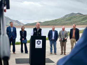
Jennifer LaVista, a public affairs specialist with USGS, said a streamgage on the South Fork near Hunstville has been monitoring the streamflow of the river for 100 years now. Originally put into service on March 21, 1921, LaVista said the streamgage is one of 25 “centennial gauges” in Utah.
The USGS, a scientific agency of the United States government charged with studying the country’s natural landscape, was established in 1879. Ten years after the formation, the organization determined it needed to inventory the flow of all streams in the western United States to evaluate their potential for crop irrigation. In 1889, LaVista said, the foundation for modern water management was laid with the installation of the first streamgages, including two in Utah on the Weber and Spanish Fork rivers.
Some 30 years later, the Huntsville gauge was installed. USGS Utah District Engineer A.B. Purton made the first streamflow measurement at the site on March 22, 1921. To date, LaVista said a total of 1,115 streamflow measurements have been made by hydrologists at the streamgage.
“This century-old streamgage doesn’t just report river flows — it helps to ensure public safety, environmental protection and wise economic development,” LaVista said.
Data pulled from USGS streamgages has a wide variety of applications, from managing river flows and forecasting floods and droughts, to delivering water supplies and establishing water rights.
“Long-term streamflow information is invaluable for understanding climate and water supply trends,” LaVista said. “Which is particularly important in the arid west.”
The equipment is also used to protect threatened aquatic habitats. Ben Nadolksi, director of the Utah Division of Wildlife Resources Northern Region, said his outfit relies heavily on data generated by streamgages. The agency is charged with managing and protecting all wildlife in Utah, which includes the state waters that hold fish.
Chris Penne, a scientist and aquatics program manager with DWR’s Northern Region, said the equipment allows for a more symbiotic relationship between the DWR, whose concern is wildlife, and regional water distributors who make sure communities are being supplied with the right amount of water.
“(Streamgages) give you real-time, basically up-to-the-minute data about a particular river,” Penne said. “That allows for (water managers and distributors) to make more precise decisions. And that has helped the aquatic life tremendously.”
La Vista said the equipment used to collect stream data has changed significantly over the past century. At the Huntsville gauge, data was collected about every month, and was then used to calculate average daily stream flow. River data was compiled into reports that were presented to the public every two years.
But today, river height is measured every 15 minutes using advanced equipment and is then digitally recorded and transmitted every hour through a satellite to the USGS, LaVista said. The public can access real-time streamflow information on the internet using the USGS National Water Dashboard.