Local News
25th Ogden Marathon: Nelson sets women's record; Berlin wins on his birthday

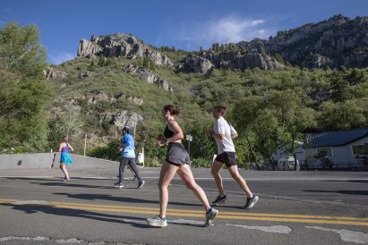
PHOTO GALLERY: See more photos from the race and festivities OGDEN — On the silver anniversary of the Ogden Marathon, Paige Nelson had a gold medal performance. Nelson, 37, a stay-at-home mom of five, traversed the 26.2-mile course in a women’s record time of 2:38:28 during the 25th running of the race with the finish line at historic 25th Street and Grant Avenue on Saturday. She smashed the previous mark of 2:42:40, set by Sariah Long in 2017, by more than 4 minutes. “I knew the course record was 2:42 and thought, maybe ... tried to keep it conservative in the beginning, ...